
Precise Landscape Model for Simulating Flood Scenarios
RAKU® TOOL MB‑0600 for hydraulic engineering

When large volumes of water impact infrastructure, knowledge determines safety. In collaboration with the Austrian Service for Torrent and Avalanche Control, the University of Innsbruck is analyzing realistic flood scenarios to protect people and infrastructure.
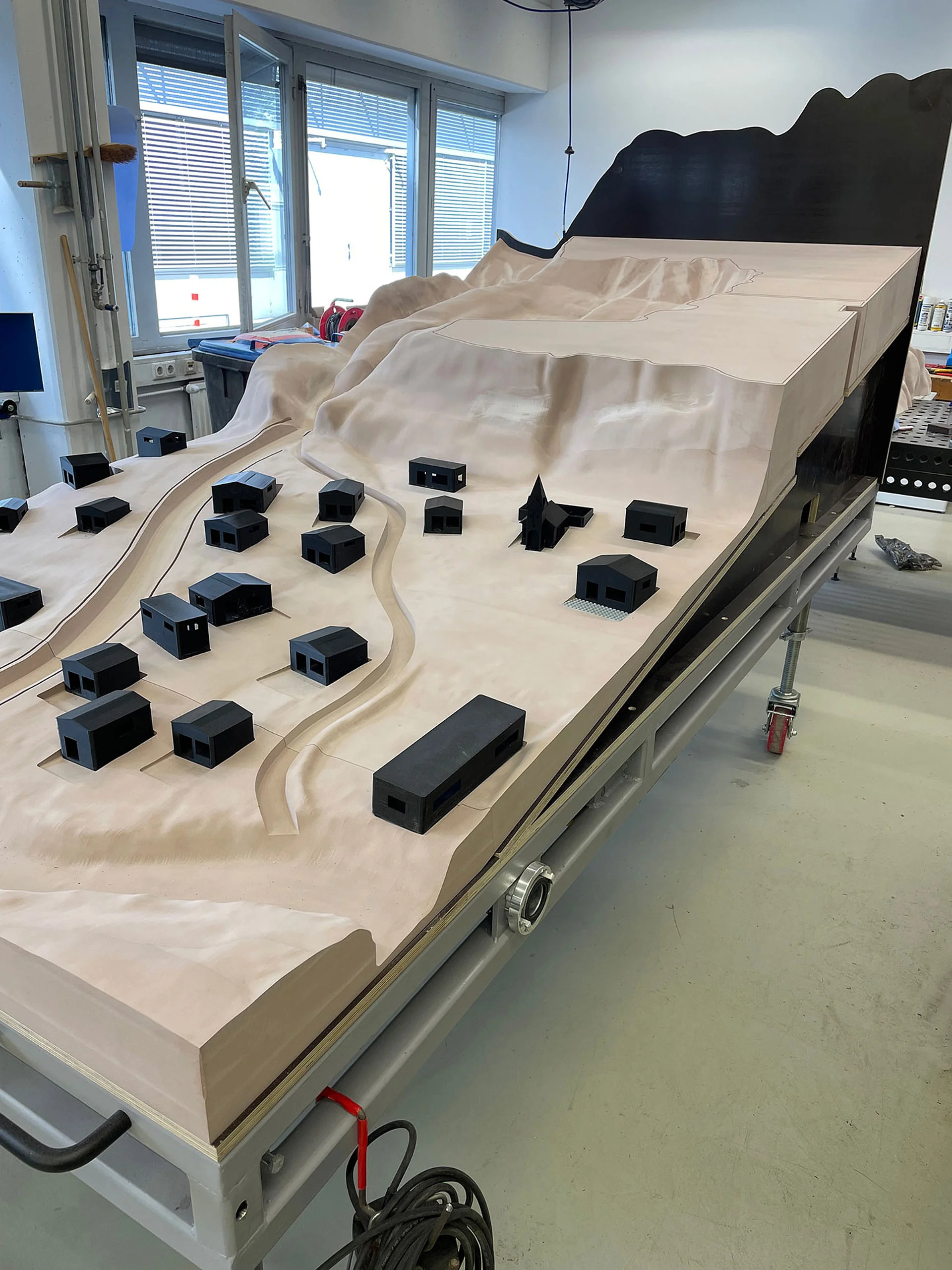
To support this effort, a high-precision landscape model was manufactured from RAKU® TOOL MB‑0600 polyurethane modeling board material. This physical model enables realistic analysis of complex flow dynamics and flooding, and thus also serves as a flood model for hydraulic engineering.
The landscape model is used to simulate flood events and is specifically deployed as a flood modeling tool.

Requirements for a precise landscape model
To ensure that a landscape model can be reliably used as a flood model, it must meet the highest standards:
- Accurate topography for realistic runoff and flow conditions
- Water-resistant performance for wet testing
- Combination of low weight and high robustness
- High-precision machinability for finest terrain features
Solution: Landscape model made from RAKU® TOOL MB‑0600
The landscape model was manufactured from RAKU® TOOL MB‑0600 modeling board material as follows:
- Bonding of board materials
- CNC milling based on CAD data
- Surface finishing and coating
The result: a highly precise, durable model with exact topography, suitable for both landscape and flood models.
Product Information: RAKU® TOOL MB-0600
Your Benefits
- Maximum precision: Ideal for highly detailed landscape models via CNC machining
- Finest surface structures: Accurate representation of ditches, embankments, and structures
- Water resistance: No warping, or swelling when exposed to water
- High mechanical stability: Robust and durable in use
- Low weight: Easy transport, even for large landscape models
- Paintability: Enables realistic visualization
Advantages of a physical landscape model in hydraulic engineering
Global Support. Anytime. Anywhere.